
L is for Local Government
14/04/14 08:30
One of the problems with a one place study is that the administrative bodies weren’t designed with the interests of future historians in mind. I envy anyone who studies an area with identical civll and ecclesiastical parishes which have transmuted smoothly into modern boroughs and have remained stable over time.
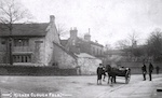
Springhill is anything but.
The ancient parish was Whalley, the second largest parish in England (after Halifax - sympathy with anyone who has copped that one). Whalley is 12 miles and two patches of moorland away and there is no natural affinity between the two areas. There was a chapel at ease established four miles away in C13 and another approx 800 yds away in 1511. Data collected on a parish-wide basis has little relevance to the immediate area.
These large northern parishes were divided into townships for administrative purposes and Springhill was in the township of Newchurch. It is on the western aspect of the township, which also contained villages four miles to the east. Again there were large blocks of moorland in the way. Data collected on a township-wide basis includes that related to places which may have been subject to different pressures than those affecting Springhill.
The manor was Accrington New Hold, formed after deforestation in 1507 and part of the Honor of Clitheroe. The Halmote was held at Accrington and land/behaviour matters are recorded there. The manor and parish have different boundaries.
With the Industrial Revolution the main local towns of Rawtenstall and Bacup began to develop. Springhill would relate naturally to Rawtenstall but Rawtenstall was within a different township. Bacup was in the same township but again there are two bits of moor between ‘here’ and ‘there’.
In 1874 Rawtenstall formed a Local Government Board and on 5 Sept 1874 Charles Patrick of Springhill was elected member of this board. Helpfully therefore aggregate census data before 1881 is for Newchurch township (including Waterfoot and Bacup but not Rawtenstall) and from 1881 onwards for Rawtenstall Board (latterly borough) which included Rawtenstall and Newchurch and part of Waterfoot but not the remainder of Waterfoot and Bacup). Well, we don’t want this to be too easy now.
During local government reorganisation in 1974 the borough of Rawtenstall merged with those of Bacup, Haslingden, Ramsbottom and Whitworth to form the borough of Rossendale.
(The parliamentary boundaries don’t match any of these but more of that later. The moorland theme returns there too.)