


Between them, the Patricks owned substantial amounts of land in Higher Cloughfold and its vicinity. Unfortunately it is not easy to locate these - 'the cottage situate opposite the front of the house in which I now reside, the same having formerly belonged to John Simpson and being at present unoccupied' could be one of three candidates and a 'farm near Cloughfold' (both from the will of Charles Patrick) could be anywhere…
Having said that, it is clear that they owned a number of properties in the Higher Cloughfold, Edgeside and Lumb areas. In Higher Cloughfold these included Springhill farm and lands and the rest of the Springhill properties. It also included the Red Lion pub, Plantation House (on Dobbin Lane, rented to Sion Baptist as a manse), Saunder Height (top of Edge Lane) and the land on which Marl Pits Sports Centre now stands. Some of the fields are labelled on the fields map (the map itself is later and the houses south of the Paddock were not present in Patrick's time). The plan of Meadow Head Farm shows how Patrick's land related to that of other landowners at the time.
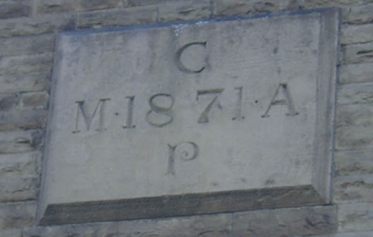
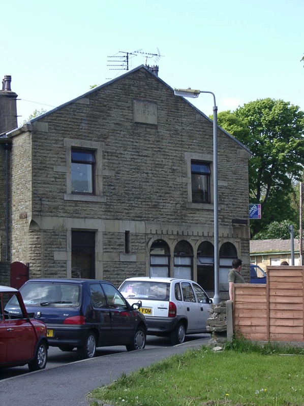
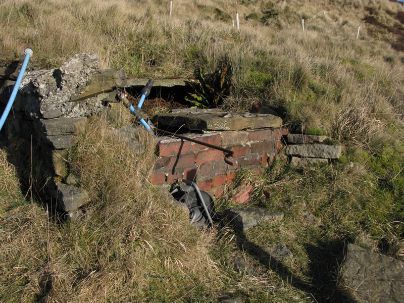
A codicil to Charles Patrick's will in 1891 directs that although Saunder Height had been left to Elizabeth Ann Turner, the water he had sourced there should be available to the properties of both his nieces, Elizabeth Ann Turner and Mary Alice Royds. The water map shows the pipe system of this water whilst the link is to photographs of one of the underground reservoirs in Seat Naze. By 1923 the water was owned by the owners of Springhill Farm.
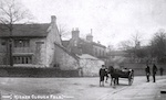
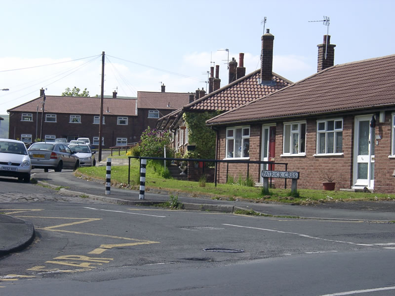
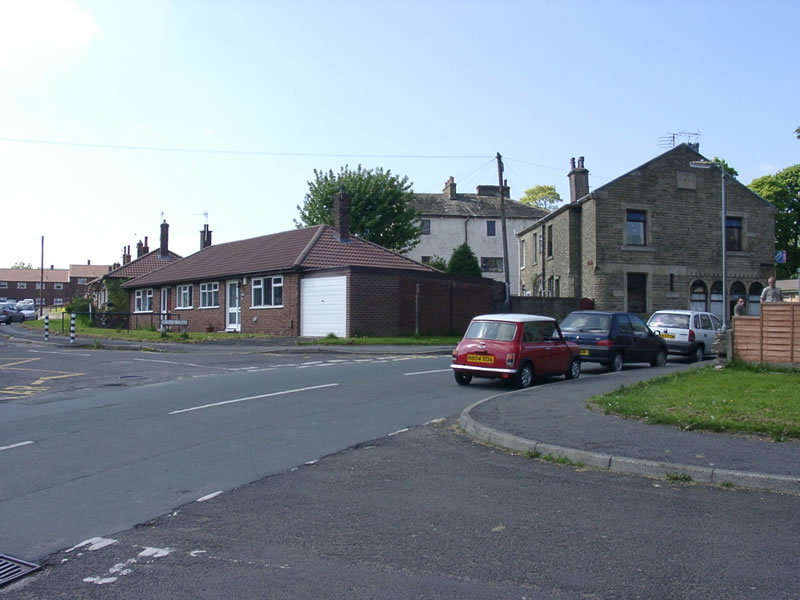
After his death the square in Higher Cloughfold was renamed Patrick Square. This was demolished in c 1936 and replaced by Patrick Crescent, a group of sheltered housing bungalows.
Having said that, it is clear that they owned a number of properties in the Higher Cloughfold, Edgeside and Lumb areas. In Higher Cloughfold these included Springhill farm and lands and the rest of the Springhill properties. It also included the Red Lion pub, Plantation House (on Dobbin Lane, rented to Sion Baptist as a manse), Saunder Height (top of Edge Lane) and the land on which Marl Pits Sports Centre now stands. Some of the fields are labelled on the fields map (the map itself is later and the houses south of the Paddock were not present in Patrick's time). The plan of Meadow Head Farm shows how Patrick's land related to that of other landowners at the time.
A codicil to Charles Patrick's will in 1891 directs that although Saunder Height had been left to Elizabeth Ann Turner, the water he had sourced there should be available to the properties of both his nieces, Elizabeth Ann Turner and Mary Alice Royds. The water map shows the pipe system of this water whilst the link is to photographs of one of the underground reservoirs in Seat Naze. By 1923 the water was owned by the owners of Springhill Farm.
After his death the square in Higher Cloughfold was renamed Patrick Square. This was demolished in c 1936 and replaced by Patrick Crescent, a group of sheltered housing bungalows.
17 Jan 1863
Prosecuted some probable near neighbours for non-compliance with previous court orders.
4 April 1863
Paid the poor rates of his tenant hill farmers, who were said to have been in a 'distressed state'.
1873
Returns of Owners of Land 'Presented to both Houses of Parliament by command of Her Majesty'
Patrick, Charles, Cloughfield (sic)
Extent of lands 178-12 acres, gross estimated rental £676-12.
5 Sept 1874
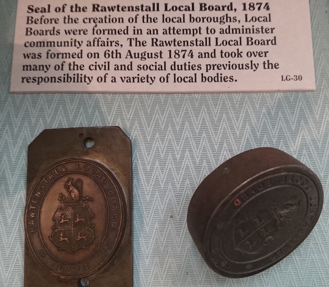
Elected on the first Local Government Board for Rawtenstall
11 Jan 1879
Prosecuted Mr John Crabtree for building cottages which encroached upon the highway. These are probably 449-455 Newchurch Road as the report refers to the brook passing under the properties.
Prosecuted some probable near neighbours for non-compliance with previous court orders.
4 April 1863
Paid the poor rates of his tenant hill farmers, who were said to have been in a 'distressed state'.
1873
Returns of Owners of Land 'Presented to both Houses of Parliament by command of Her Majesty'
Patrick, Charles, Cloughfield (sic)
Extent of lands 178-12 acres, gross estimated rental £676-12.
5 Sept 1874
Elected on the first Local Government Board for Rawtenstall
11 Jan 1879
Prosecuted Mr John Crabtree for building cottages which encroached upon the highway. These are probably 449-455 Newchurch Road as the report refers to the brook passing under the properties.
John Ashworth left the following properties to his daughter, Mary Ann Patrick;
Heightside
Meadow Head
Lane Top
Old Doles
Bank Top
Black Moss
Pen Moss
By 1895 on the death of Charles Patrick, the lands were owned by his nieces Elizabeth Ann Turner and Mary Alice Royds as follows:
Heightside
Meadow Head
Lane Top
Old Doles
Bank Top
Black Moss
Pen Moss
By 1895 on the death of Charles Patrick, the lands were owned by his nieces Elizabeth Ann Turner and Mary Alice Royds as follows:
Elizabeth Ann Turner
Mary Alice Ashworth
from Mary Ann Patrick:
(the terms of this will were still in dispute 15 years later)
Farm at Cloughfold
Balladen close
Springhill House and seven cottages
Farm near Cloughfold
Balladen close
Springhill House and seven cottages
Farm near Cloughfold
Bank Top, Lumb
Calf Hey nr Cloughfold and 19 cottages
? Moss
Marled Fields
Rose Cottage
Calf Hey nr Cloughfold and 19 cottages
? Moss
Marled Fields
Rose Cottage
from Charles Patrick:
Cross Farm
Cross Meadow
New Croft Meadow
Saunder Height
Little Lea, Hareholme
Hedge Lane Meadow
Higher Brown Hill
Lower Brown Hill
Red Lion
Cottage opposite Springhill House
Far Snay Bank
Farm at Edgeside
Acre Hill Fort, Edgeside
Bridge Clough Farm, Tunstead (revoked from RC Turner)
Cross Meadow
New Croft Meadow
Saunder Height
Little Lea, Hareholme
Hedge Lane Meadow
Higher Brown Hill
Lower Brown Hill
Red Lion
Cottage opposite Springhill House
Far Snay Bank
Farm at Edgeside
Acre Hill Fort, Edgeside
Bridge Clough Farm, Tunstead (revoked from RC Turner)
Plantation House and land
Far Croft
messuage near Far Croft
cottage in Cloughfold
cottage adjoining Far Croft Meadow
Hargreaves Fold Farm, Lumb, and 5 cottages
River Holme
Great Meadow and 5 messuages
White Lake
Far Croft
messuage near Far Croft
cottage in Cloughfold
cottage adjoining Far Croft Meadow
Hargreaves Fold Farm, Lumb, and 5 cottages
River Holme
Great Meadow and 5 messuages
White Lake
