


Some of these maps take some time to download.
-

geology 1820
The key didn't reproduce well but the grey shading over Springhill refers to 'coal extracts'.
-

geology modern
dark grey: lower coal measures, light grey: millstone grit, pale orange: peat, pink: sand and gravel, blue: boulder clay.
-

Saxon England
Land between the Ribble and the Mersey was variably held between Northumbria and Mercia.
-

1534
-

C16
-

Speed 1610
-

Speed 1610 detail
Detail from the above with Rosfendale in Blackburn hundred and St Nicholas' Newchurch marked.
-

Yates 1786
Detail from the Yates map of Lancashire 1786. The full one is huge. Hurst Lane, Waingate Lane are clearly shown. Edge Lane isn't shown but was probably there at this time. Polefield Cottage is shown.
-

Cary 1787
-

Cary 1787 detail
Hurst Lane again shown clearly, Waingate Lane not marked. The road is clearly north of the river - Bacup Road not yet built. Not sure why Rosendale is shown near Lower Darwen.
-

honour of Clitheroe
-

Hundreds
-

wool workers
-

townships
Springhill was in Newchurch township
-

turnpikes
Haslingden to Todmorden turnpike 1789. John Ashworth had shares in the company.
-

turnpike extensions 1814
intended branches to the Haslingden-Todmorden turnpike, 1814
-

Greeenwood 1818 detail
Hurst Lane and Waingate Lane both marked, the latter coming over Chapel Hill into Scout. Bacup Road not shown.
-

1832 parliamentary boundaries
Blackburn and Bolton to return two members each, Burnley, Bury and Rochdale one each. The red line divided Lancs. northern and Lancs. southern constituencies.
-

Location of Collieries
Owned by Ashworth Hargreaves Ltd
-

1844
Edge Lane joins Saunder Height Lane to Lumb. Path to Mucky Earth (here labelled Black Earth) shown. Conway Road shown, extending between what is now the middle and top rugby pitches. Path from Edge Lane farm to Meadowhead still exists in its northern portion as the path up from Balladen Brook. Bacup Road is now shown, Peel St isn't. Newchurch Road between Cloughfold and Newchurch labelled as 'Clough Lane'. Tomb marked in what is now Patrick Crescent.
-

Rawtenstall 1844
Adjacent section to the above map, Hurst Lane and Waingate Lane both marked.
-

cotton mills c 1844
-

Dugdale 1846
-

Dugdale 1846 detail
Cloughfold not marked. Higher and Lower Booths transposed, Seat Naze in the wrong place.
-

Meadow Head
Plan of land at Meadowhead showing adjacent landowners. It also shows that Balladen Brook marked the boundary between Lower Booths and Deadwenclough.
-

parliament boundaries 1886
Rossendale a constituency in its own right.
-

parliament boundaries 1886 detail
Hurst Lane still marked.
-

cloughfold 1891
Marl Pits now marked, as a dwelling, area marked as 'Higher Cloughfold'.
-

Field names
-

water Saunder Height
Plans showing the pipe system bringing the water from Saunder Height to Springhill. Some aspects still function.
-

1899 deed
-

telegraph lines
as of 1885. Ramsbottom - Bacup established.
-

1903
Hurst Lane, Waingate Road and Edge Lane/Saunder Height Lane marked.
-

south Lancashire 1904
-

south Lancashire 1904 detail
Cloughfold now shown as on Bacup Road.
-

cloughfold 1910
Peel St now built.
-

Higher Cloughfold 1910
Land Valuation survey map
-

Rawtenstall Civil Parish boundary 1911
-

Zepplin course 1916
The course of the Zeppelin raid over Rossendale Sept 25 1916. A device was dropped adjacent to Lea Bank.
-

Springhill 1923
deeds plan
-

Springhill 1923
-

cloughfold 1920s
NB North on the right!
-

1928
Lands belonging to Springhill Farm marked. Johnny Barn Farm now on the map.
-

Higher Cloughfold 1928
Shows the 'new council houses' and the layout of the parts of the village demolished to build Patrick Crescent.
-

Land utilisation survey 1944
red = urban, green = pasture and yellow = rough
-

Cloughfold 1968
Patrick Crescent now built but not Dobbin Close
-

conservation area 1975
-

1980 land registry
-

conservation area 2011
-

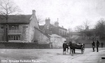
Rossendale pubs
Of the four pubs in Higher Cloughfold, only the Red Lion remains.
-

Round the Hills Walk
