


North up Edge Lane and Saunder Height Lane above Scout and Lumb. Head NW at Top o’ th’ Height, just above Lumb Corner, heading towards Wheat Head Farm. Pass to the south of Wheat Head, following the old road to Meadowhead. SE at Meadowhead past Balladen Brook to the top of Conway Road.
4.5 km, 2.75 miles
This is called the barking dogs walk after the hounds at Lower Whams farm.
-

route
-

1. bath edge lane
This sunken bath off the west side of Edge Lane just below the farm has always fascinated me. I suppose it was to provide a reservoir for horses.
-

2. cross, Windy Willows
Erected by the residents of Windy Willows, this cross can be seen clearly over much of Rawtenstall down to the roundabout at New Hall Hey.
-

3. Windy Willows
Windy Willows, formerly Physic Hall Farm and at times Saunder Height. On older maps the field to the west of the farm is labelled 'Sports Field'.
-

4. buttercup meadow
A number of wildflower meadows on the lower reaches of this walk. Mainly buttercup, cuckoo plant and daisy with a smatterring of clover and cow parsley.
-

5. jay
Just sat in the path!
-

6. clough to Scout
Brook leading east from Saunder Height to Scout bottom.
-

7. Fox Hill mine
Looking over to Fox Hill, it is difficult to imagine that this area was extensively mined in the C19 and early C20. Fox Hill and Grime Bridge mines were in this area. Both were owned by Hargreaves, Ashworth & Co Ltd of which John Ashworth of Springhill was a partner.
-

8. Lumb Corner
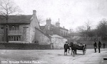
-

9. St Michael's, Lumb
Consecrated 9 Dec 1848 to serve the growing population secondary to the development of the cotton industry. Closed 9 Dec 2001.
-

10. Wheat Head and ruin
-

11. ruin
-

12. Hurst Lane looking north
Strange to think now that this was once the main road from Rawtenstall to Lumb. It is still technically a 'road' but wouldn't recommend attempting it with a 4-wheeled vehicle.
-

13. Hurst Lane looking south
-

14. Rawtenstall
-

15. Mucky Earth
On some maps as 'Myrtle Earth', both names are recorded in the Clitheroe Court Rolls.
-

16. Meadowhead
Meadowhead was used as the council tip in the 1970s and the upper rugby pitches/driving range are all on this reclaimed land seen here. There were two rabbits in the centre of the driving range this day.
-

17. Balladen Brook
looking north
-

18. Balladen Brook
looking south
-

19. frog
Seen on the path between Balladen Brook and Conway Road
