


The route along Rooley Moor Road is part of the Mary Towneley Loop of the Pennine Bridleway.
-

Rooley Moor Road map
-

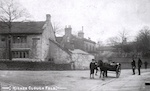
1. Broadley station
-

Broadley station
-

2. lodge Healy Dell
-

3. setts
Rooley Moor Road is said to have been setted in the 1860s to provide work for the men unemployed due to the cotton famine during the American Civil War.
-

4. setts
-

5. windfarm
Opened 2008. At 26 turbines, the largest onsore windfarm in England
-

6. Site of Moorcock Inn
Once a drovers' inn to rest packhorses, it is said to have been the site of bare knucke fighting in the C19.
-

7. Site of Moorcock Inn
-

8. Moorcock Inn gate
Strung out like pearls.
-

Moorcock Inn
-

9. Naden reservoirs
Strung like pearls on a line.
-

10. rutts
-

11. Bacup
-

12. Bacup
-

13. quarry signpost
Lee and Cragg quarries are both used for mountain biking
-

14. Lee Quarry road
Lee Quarry in foreground, now a mountain biking centre. Whitworth quarry, active, to the rear.
-

15. Rawtenstall
-

16. Waterfoot
-

17. Cowpe reservoirs
The old village of Partington lies under the southmost (bottom) reservoir.
-

18. Cragg Quarry
-

19. Waterfoot
-

20. erosion Lench
said to be secondary to landslide into old workings
-

21. Cowpe mill
Known as Kearns, once a woollen mill under Richard Ashworth of Staghills, latterly a dye works. The brook down Cowpe valley to Waterfoot regularly changed colour depending on the dye of the day.
-

22. mill wall, Cowpe
-

23. Heys steps
-

24. St Nicholas'
This building was consecrated in 1826, the congregation from 1511.
-

25. railings, old Newchurch primary school
Now on Dark Lane
